ACCOMMODATIONS
We intended to camp for much of our trip, in order to keep costs within
reason, and to be able to be based in areas lacking other
accommodations. Roofed accommodations are available, and
are
understandably pricey, but we did use them occasionally. Those
that we used are described further in this report -- we made
our choices from information on web sites and in the travel guides.
Camping is a good option. There is a fine system of territorial
parks in the Yukon, as well as in the NWT. In 2007 the Yukon
rates
were $12.00 / night, while in the NWT they were $10.00 /
night. Most campgrounds offer limited facilities, usually
no more than campsites (with tent pads), pit privies, water, and a
screened kitchen shelter. Bear safes for food are sometimes
present,
though we used our vehicle. Firewood is often
available. Most
campgrounds are not staffed, so campers are expected to pre-purchase
their campground permits and self-register their site (instructions
regarding how this is done is given in each campground). Permits
can be purchased in Whitehorse, though no longer through the Yukon
Tourist Information Bureau, despite what some web sites will tell
you. We purchased ours in the
Canadian Tire store in
Whitehorse which, due
to the various hardware and camping
supplies it offers, will likely be an inevitable stop. This store
is not hard to find. Every single resident of the city can
direct you there.
In the NWT the only campground we used was staffed, but they otherwise
have self-registration on-site. The Alaska state parks
were staffed with volunteer campground hosts, who collected the camping
fee. And in Kluane National Park you may obtain the camping
particulars at the Visitor Centre in Haines Junction. (We didn't
camp in Kluane, but stayed with friends.)
EQUIPMENT
We brought most of our camping equipment with us, but if that is not a
practical option for you, yet you still wish to camp, there are local
outfitters from whom most of the necessaries may be rented.
We required a propane camping stove, as our white gas camping stove is
awkward to transport by air -- the gas cannister gives the airlines
concern, and the clearance hassle is more trouble than it is
worth. We arranged to rent a propane camping stove from
Up
North Adventures,
103 Strickland Street in Whitehorse, phone: (867) 667-7035. A
three-week rental was only $30, and the necessary propane cylinders are
available in many locations, including, of course, Canadian Tire.
We also rented two self-inflating sleeping pads as a back-up for our
air mattress; this cost only $10 for the three weeks. You can
also purchase Yukon Territorial Park camping permits.
We took along our own camping kit and exploration supplies, but we
found the following items particularly useful, and sometimes
indispensable:
- Bug Jackets. Yes,
there are biting insects, legions of biting insects beyond measure,
particularly (though not usually simultaneously) mosquitos and black
flies. As a principle we try to limit the use of insect
repellent, and I have no difficulty using binoculars or cameras while
looking through the insect mesh of a bug jacket. Bug Jackets are
widely available in Canada through the various hardware store chains,
and can be easily purchased on-line through the Mountain
Equipment Co-op, for about $15. Our bug jackets
were always close to hand when not being worn. Do not explore the
Yukon without
one. If you still insist on repellent, use a formulation that
contains 30% DEET, the maximum now allowable in Canada. We carried some
as a back-up. Northern
bugs are indifferent to any non-DEET repellent (NOTE: Permithrin is not
permitted for sale in Canada).
- Propane Camping Stove.
We bought a six-pack of small propane canisters, and used about an
average of one a week. We decided that the propane stove was much
superior than our white-gas stove -- easier to light, maintain, and
clean, and cooking was fast and efficient.
- GPS. A good GPS
unit with the necessary topographic maps was a plus, and much more
convenient than carrying around paper topographic maps. We never
had a problem obtaining good satellite reception.
- Trekking poles.
With my knees (of a certain age) I find trekking poles of great utility
for ascending and descending hills and mountains -- and there are a lot
of these in the Yukon. Highly recommended. Available,
of course, through the Mountain Equipment Co-op.
- Car charging adaptor.
This was a great little device that we bought in Canadian Tire.
It fitted snugly into the vehicle's cigarette lighter element, and we
could then plug our various electronic devices into it, most frequently
our battery charger for the digital cameras. Since we drove
nearly every day we never lacked for battery power.
- Insulated Coffee Mug /
French Press combo. I like (need) to start my day with
coffee, and this specialty mug was my favourite
piece of travel equipment. It was a thermos travel mug with a
built-in French press, so preparing the morning cuppa was
simplicity. I found it at Mountain Equipment Co-op -- they
carried more than one model.
- Thermos (vacuum flask).
We had many early starts and found it very convenient to boil water the
previous evening and store it overnight in a good-quality thermos, so
that the morning coffee and muesli preparation was effortless.
- Eye Mask. Given the
latitude and the time of year we were in 24-hour daylight, and an
opaque eye-mask let us have a good night's sleep.
- Digital Photo back-up. I
didn't wish to carry a lap-top computer, so I used a small portable
hard-drive upon which I could daily download my digital photos.
- 20 litre gasoline can.
It can be a long drive between service stations, though never further
than a tank of gas. Having the emergency supply, however, does
allow a certain amount of back-and-forth exploration en route, within
reason.
- Small waterproof pad.
This did double-duty, both as a seat cushion during driving, and to
facilitate my comfort during macro photography of the numerous
arctic/alpine "belly plants".
- Queen-sized Inflatable Air
Mattress, with battery-powered pump. Hardy campers
will sneer at this addition to our equipment list, but we had purchased
a new four-person tent for this trip (retiring my two-person tent after
30 noble years of service), and I wished to be able to enjoy my
new-found luxury of room inside the tent. The mattress was
glorious.
- Cell Phone (not) and Walkie
Talkies (yes). We didn't bother with a cell phone, as
coverage rarely extends far from settled areas. If you must have
a communications link you'll need a satellite phone. We did carry
two walkie-talkies, but as the photographer was never able to wander
far from the botanist, we didn't need them.
PRINT
REFERENCES
- Birds
by
the Dempster Highway (revised 1987), by Robert Frisch.
Though this book has not been revised or re-printed since 1987, it is
still remarkable useful. It is not carried by your typical
on-line sellers, though copies appear on Ebay for substantial prices,
but it is still available in the Yukon. It is sold at the park
office in Tombstone Territorial Park for $10 Cdn, but if you wish to
have a copy in hand before you leave home you may purchase it by
calling Maximilian's
Gold Rush
Emporium in
Dawson City, phone (867) 993-5486 or e-mail. Obviously
there have been some changes in bird life along the Dempster in the
past 20 years, especially in light of global warming, but there is
still great utility in this publication. NOTE:
the book describes habitats and sites according to the old highway
marker system. See the note above regarding distance
indicators on the region's highways, including the Dempster.
- A Bird-Finding Guide to Canada edited by Cam Finlay, revised 2000. This book is
worth seeking out. It helped with some updated information for
the Dempster, and also included some site info for Inuvik, Tuktoyaktuk,
Dawson City, and Kluane National Park.
- Birds of the Yukon Territory by
Pamela H. Sinclair, Wendy A. Nixon, Nancy L. Hughes,
Cameron D. Eckert, published by UBC press, 2003. I consulted this
hefty, authoritative volume before I left, but didn't bring it
along. A very useful resource for trip-planning.
- Flora
of the Yukon Territory, by William J. Cody, published by the
National Research Council, 1997. Martine brought along a number
of botanical field guides and references, but this is the one that was
a constant companion.
Canada's Western
Arctic, including the Dempster Highway, by the Western Arctic
Handbook Committee, 2002. ISBN 0-9687910-0-X. I found this
guide book very useful. I purchased a second-hand copy through
on-line book re-sellers. It is worth seeking out. It describes
the Dempster Hwy using the old distance marking system.
- Yukon & NWT Government Publications
-- The territorial governments offer a number of useful free publications,
available at their Visitor Centres, such as the ones in Whitehorse and
Inuvik, and at staffed campgrounds. You should also be able to
request them on-line via the territorial tourism web sites. We
found the following publications of interest:
- Yukon Butterflies -- not a thorough
field guide, but does illustrate more than 30 commoner species.
- Yukon Wildlife Viewing Guide
(Along Major Highways) -- a very useful publication, referencing many
productive sites along all the Yukon's popular highways. Anyone
with a particular passion for butterflies should bring along The Butterflies of Canada, the essential
reference. There is also a
web site for reference.
- Driving the
Fire Belt - North Klondike Highway -- a balanced description of
the forest fire regime in the Yukon.
- NWT Road and Campground Guide
-- a necessary guide, that also provides ferry schedules for the
Dempster Highway.
- NWT Artwork Brochures -- native
arts and crafts are a special feature of a trip to this part of the
world, and this series of brochures introduces you to the various
specialites -- Quillwork, Tufting,
Tanned Hides, Beadwork, Carving, Birchbark Baskets. Note:
some of the artwork and crafts does include (non-endangered) animal
products (hides, hair, quills, bone), so make sure you are permitted to
return home with these items.
- The Last Great Road Trip Travel Guide
(Alaska & Yukon) -- a useful adjunct to the government
publications, and includes coupons for gasoline (petrol) discounts at
some service stations.
ITINERARY:
24 June --
flew from Halifax, Nova Scotia, to Whitehorse, via Montreal and
Vancouver. Overnight in Whitehorse.
25 June --
Whitehorse area, overnight in Whitehorse.
26 June --
Drove north from Whitehorse on the North Klondike
Hwy.
Overnight at Moose Creek Campground.
27 June --
DAILY
ACCOUNTS
24 June
We had an early-morning departure from Halifax for our cross-continent
journey. Given the length of the trip we chose to cash in
sufficient air miles to fly business class, which had the advantage of
not just begin wined and dined (with sufficient leg room), but we also
benefitted from an increase in our luggage allowance, which meant we
could bring along all our various camping gear, including the essential
queen-sized air mattress -- no more camping "rough".
We landed first in Montreal, and changed planes. Birds noted there from
the terminal included Cliff and Barn Swallow, and Great Blue
Heron. The next leg was the long flight to Vancouver, and we had
a longer sojourn in the Vancouver airport, during which time I saw
California Gull and Northwestern Crow, the only ones of the trip, of
course. However, the most interesting sighting was of a Little
Brown Bat flying forlornly about
inside the waiting area
opposite the departure gate. The reactions of my fellow
passengers stretched across the emotional spectrum, including a few
that were noticeably concerned. Not as concerned as the
bat, however. It finally flopped to the floor, exhausted,
and Martine threw her jacket over it, and gently picked it up.
She then attempted to convince the airline staff that they should let
her release it outside and, remarkably, they agreed. Maintenance
staff opened the necessary door to the exterior, and the bat was
released, apparently in good health.
The last leg of the trip was the flight to Whitehorse, where we arrived
at 1900 local time. All our luggage arrived (hurrah!), and
despite the hour the car rental agency was open, and they dispatched a
driver with our rental car to pick us up. We were delivered to
the rental agency from where, upon completion of the necessary
paperwork, we drove to our accommodation.
Because we arrived in the early evening after a cross-continent flight,
and we also needed to purchase food and other supplies, we chose to
stay at a Bed-and-Breakfast the first two nights. We chose the
Midnight Sun Inn Bed and Breakfast, reservation Toll Free:
1-866-284-4448,
email. Our
hosts, Farshid & Del Amirtabar, could not have been nicer, and
their hospitality was matched by the quality of the
breakfast. Recommended.
We were exhausted, and crashed.
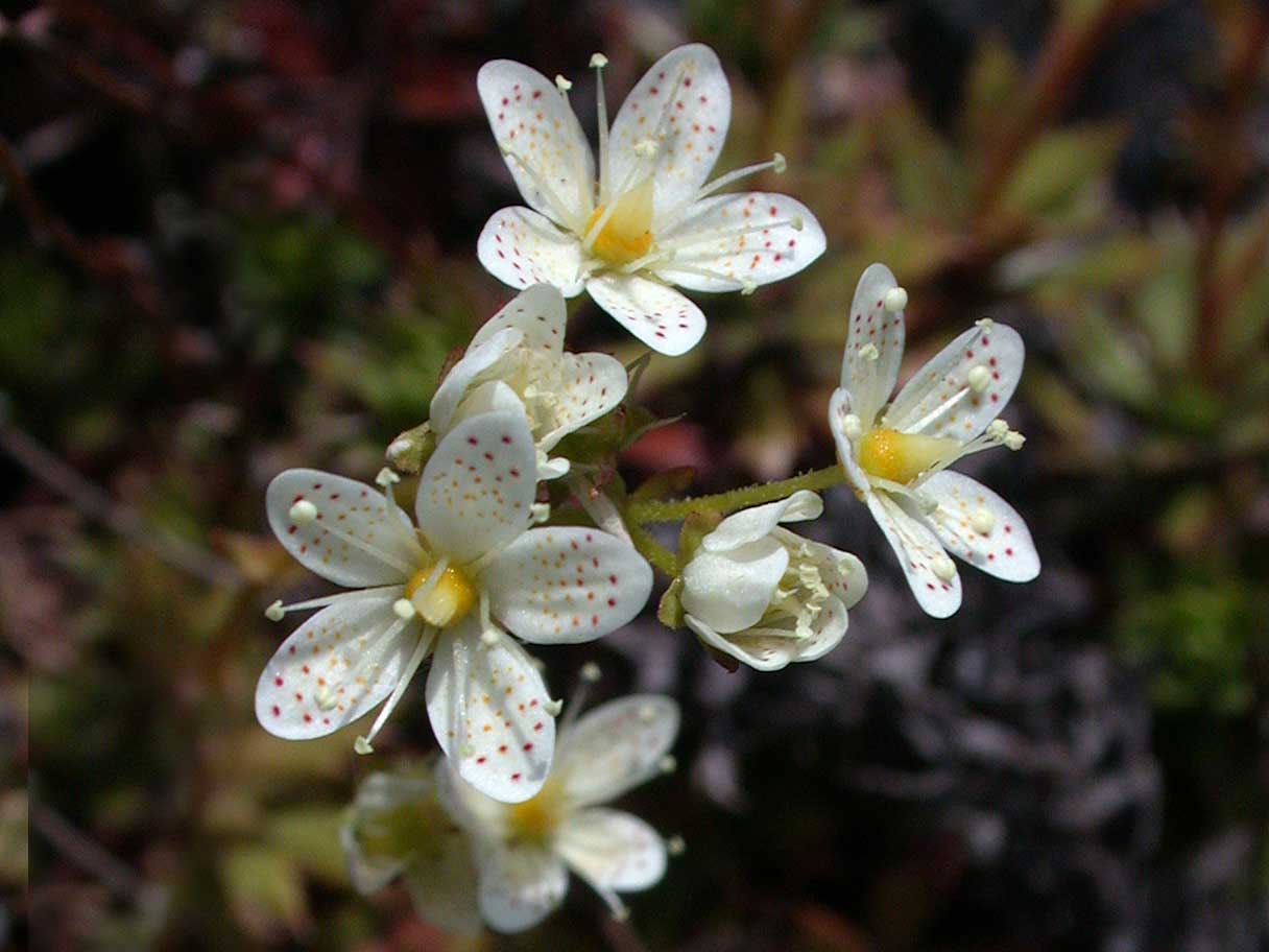
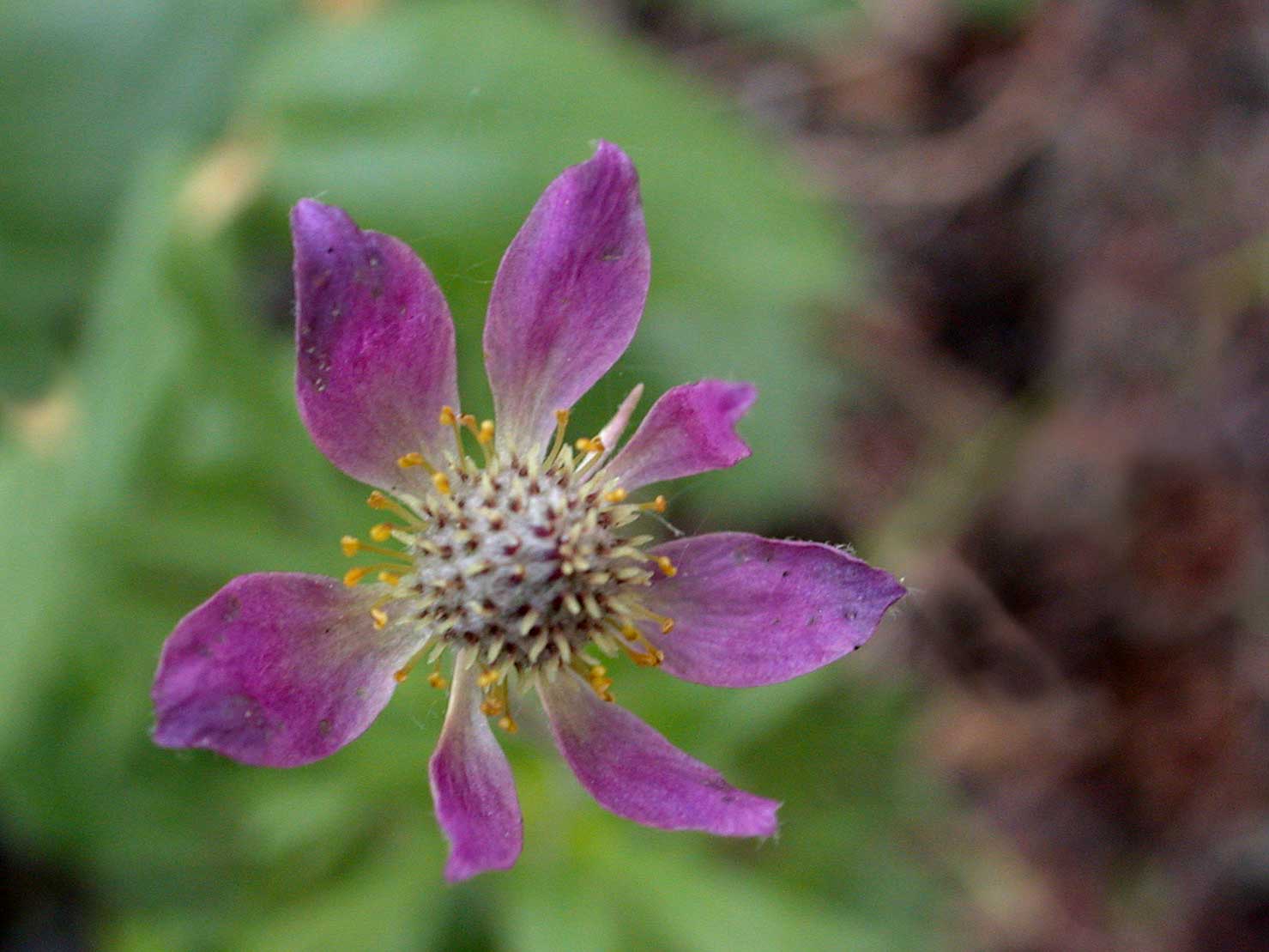
[left photo] -- Cut-leaved
Anemone (Anemone multifida)
[right photo] -- Prickly Saxifrage (Saxifraga
tricuspidata)
photos © 2007 by Blake Maybank
While the forest around the campground was primarily coniferous, there
was a good stand of deciduous (Trembling Aspens and White Birch) along
Deep Creek Road, and though the woods were fairly quiet by then (being
late morning) I did hear a
Yellow-bellied
Sapsucker, a new Yukon bird for me.
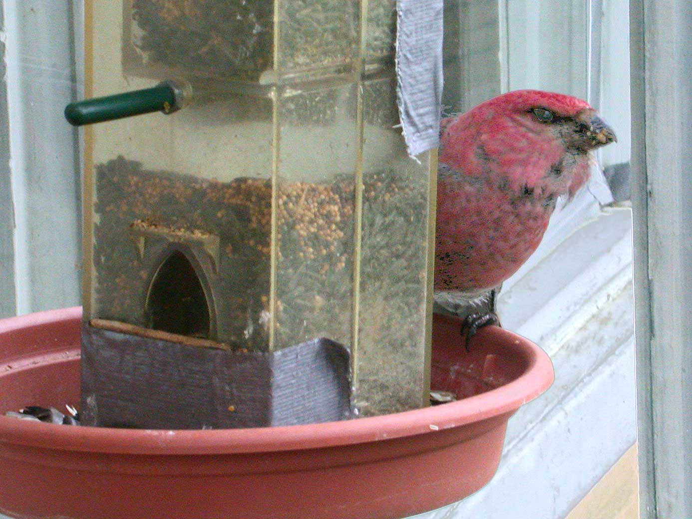
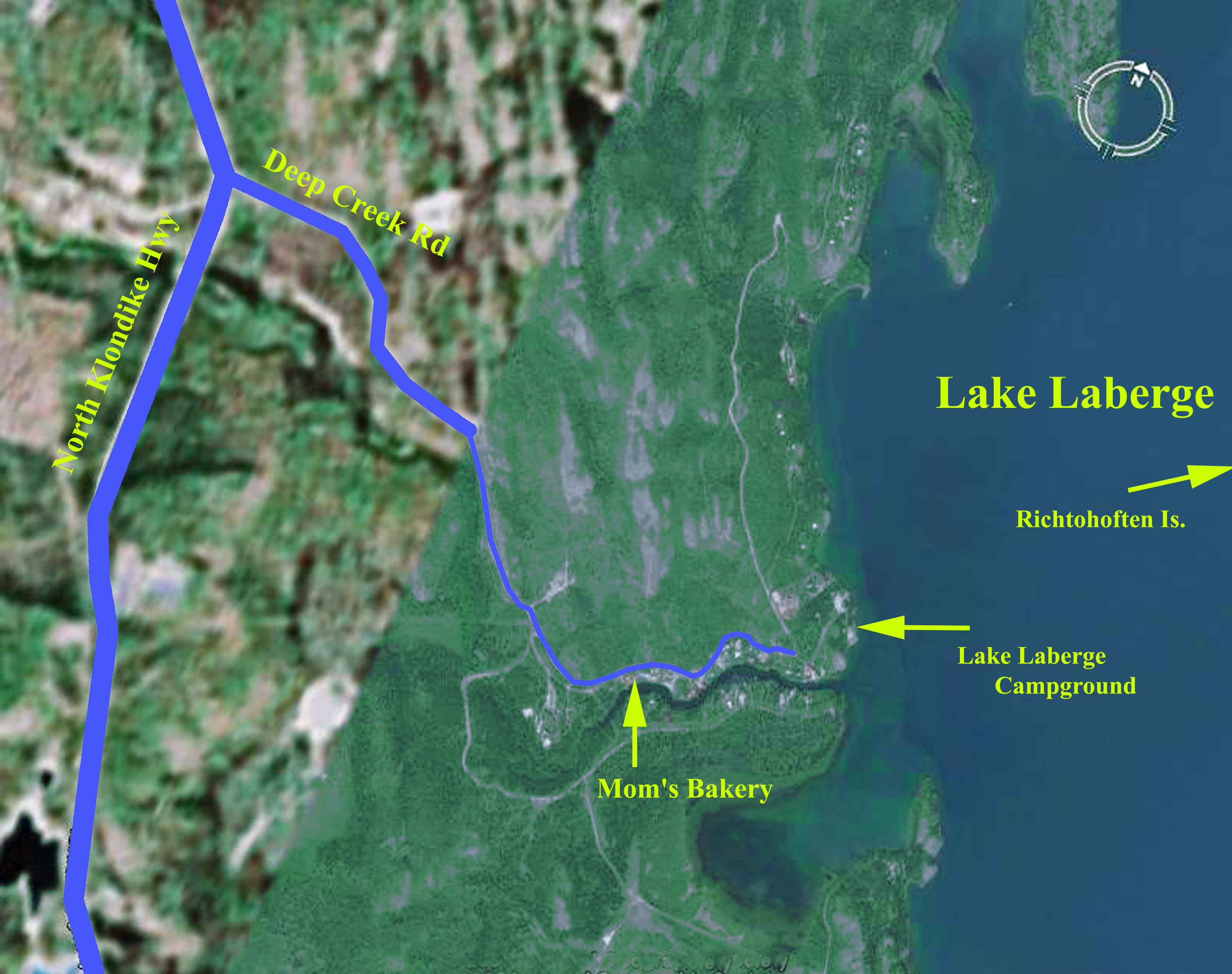
On the drive into the campground we had noted a sign announcing
"Mom's Bakery" on the south side of
the road, and we stopped on our way back out. A wise
choice. The owner has a delightful small garden with numerous
bird feeders, where I saw the only Pine Grosbeaks of the trip.
Her garden overlooks the steep bank of Deep Creek, and she has
regular sightings of Belted Kingfisher, but not while I was
present. And the bakery itself must not be overlooked, as
she sells cinnamon buns, remarkable for their girth and taste -- she
lays claim to making the second-largest cinnamon buns in the
Yukon. I misplaced my notes that mentioned where the largest are
made, so you'll have to ask "Mom" yourself. She welcomes
birders, feeder watchers, and cinnamon bun aficionados. Neither
her birds nor her buns will disappoint.
Pine Grosbeak at Mom's Bakery's
feeder
photo © 2007 by Blake Maybank
Once back on the Klondike Hwy, just a few kilometres north of Deep
Creek Road, I had a most unexpected but welcome sighting of a
Swainson's Hawk perched on a
roadside power pole. This enigmatic species is encountered
intermittently in the Yukon, with breeding as yet unproven, and it was
a welcome addition to my list.
Here is my
Lake Laberge bird list:
Common Loon
Surf Scoter
Red-breasted Merganser
Swainson’s Hawk
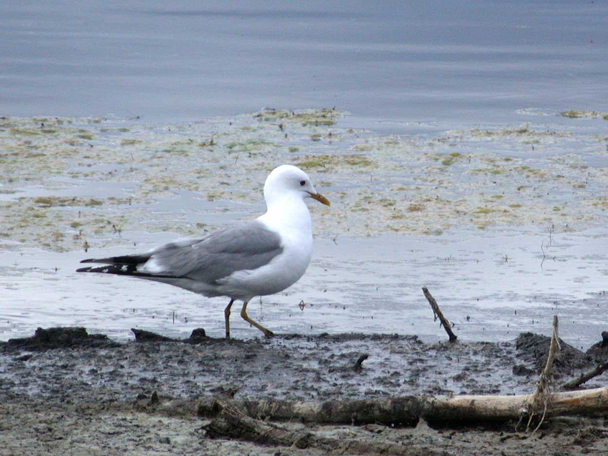
Mew Gull
American Herring Gull
Yellow-bellied Sapsucker
Northern Flicker
Least Flycatcher
Tree Swallow
Ruby-crowned Kinglet
Townsend’s Solitaire
Swainson’s Thrush
Hermit Thrush
American Robin
Black-capped Chickadee
Red-breasted Nuthatch
Gray Jay
Common Raven
Yellow Warbler
Yellow-rumped Warbler
Wilson’s Warbler
Chipping Sparrow
White-crowned Sparrow
Dark-eyed Junco
Pine Grosbeak
Purple Finch
Pine Siskin
We stopped for lunch at the Kit Kat Cafe in the village of
Carmacks. The meal was
quite good, and there was the added bonus of a Red Fox outside, coming
for handouts provided by a nearby work crew.
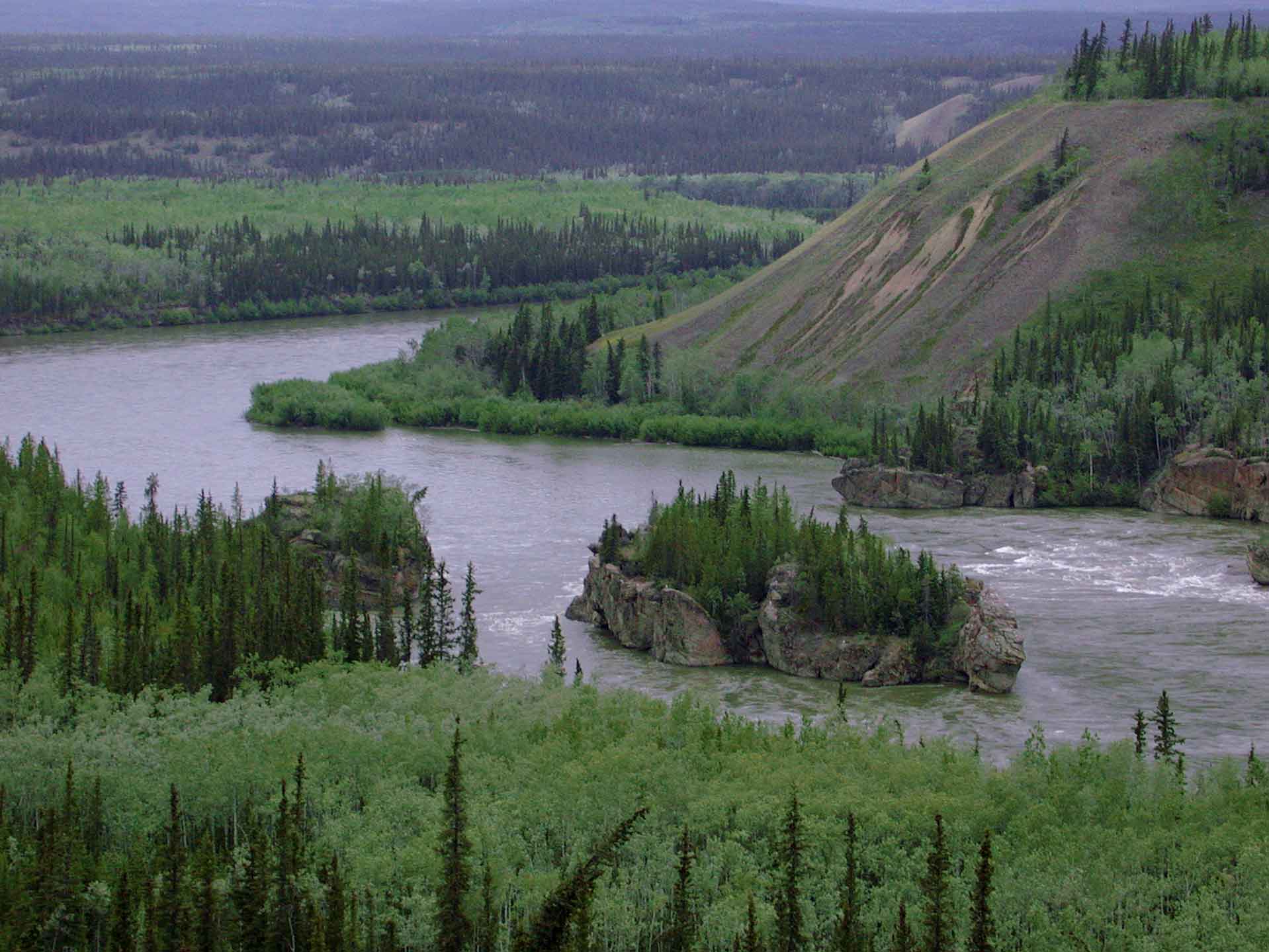
Further north on Hwy 2 we stopped at the overlook for Five Finger
Rapids, at KM 320. We chose to not climb down the long staircase
to the overlook above the rapids, but instead enjoyed the view from the
highway. These rapids posed considerable danger for the Klondike
gold rush prospectors.
These rapids mark the southern extent of
Beringia,
the ice-free corridor that persisted throughout the last ice-age,
linking Siberia with North America. Click on the above link for
more information. From our perspective it meant that we could now
look forward to a more diverse flora.
 - - - - - - -