 |
|---|
Logistics Page for
the Western Reef-Heron (Egretta gularis),
Glace Bay Big Lake Migratory Bird Sanctuary,
Glace Bay, Cape Breton, Nova Scotia
Summer 2006
| Page
Navigation Table |
| Sighting Updates Report your updates via e-mail or phone (902-852-2077) |
| Site
Directions, Orientation, and Maps Glace Bay & Schooner Pond |
| Weather & Tides |
| Tourism Information & Accommodations |
| Other
Nearby Birding Sites |
| Nearby Cultural
Heritage Attractions |
| Photos |
Sighting Updates
Note: It is reasonably assumed that this is the same individual bird that spent the summer of 2005 in
Stephenville Crossing, Newfoundland. That bird lingered on site through the first week of September,
so we may hope that the bird will remain at Glace Bay at least as long. There are no guarantees, however.
Monday 7 August - Thursday 10 August
The bird remains absent, and it seems evident it has moved on.
There will be no further updates unless the bird is rediscovered.
Sunday 6 August
No sightings despite thorough searching by a number of parties.
This marks the longest absence of the bird since its discovery.
Saturday 5 August
No sightings despite thorough searching by a number of parties.
Friday 4 August
Several parties (including the Murrants) searched unsuccessfully for the bird today.
It has been elusive in the past, however, sometimes for several days at a time.
Thursday 3 August
The bird was searched for by the Murrants at both Glace Bay and Schooner Pond, but without success.
The bird has not been found daily during its stay, so this is not necessarily bad news.
Wednesday 2 August
The bird was present again near the Glace Bay Hospital
Tuesday 1 August
Dave McCorquodale reported the bird present today near the Glace Bay Hospital.
Monday 31 July
George Crowell reported the bird present today near the Glace Bay Hospital.
Sunday 30 July
The heron was present this morning at the salt marsh by the Glace Bay Hospital (various observers).
Friday 28 July
George Crowell, with a visiting birder, reported the bird between 0800 and 0930
at the Glace Bay Sanctuary, near the hospital.
Thursday 27 July
"The heron was reported flying over Schooner Pond about 9:30 am by Monique Vassallo
and reported this afternoon by George Crowell at the Glace Bay Sanctuary
beside the Glace Bay Hospital; the bird was still present on the beach at 6:10 p.m."
Cathy Murrant
This seems to confirm the suspicion that the bird alternates between (at least) these two sites, perhaps
in response to the tides.
Wednesday 26 July
"Allan and I went to Schooner Pond this morning 6:40 a.m.
and the Western Reef Heron was in the "Upper Pond"." Cathy Murrant
Click HERE for directions to Schooner Pond
Tuesday 25 July
"The W.Reef Heron was found at Schooner Pond, just east of Donkin, by Karen Chaissons,
who is involved in a breeding bird census; she was kind enough to come to the marsh by the
hospital in Glace Bay, and four of us were led there, where we saw it about 1:15pm ADT this Tues. afternoon.
We viewed it from just outside the closed gate, on the far side of the pond."
James Swarr, Melrose, FL
Saturday 22 July
The bird was seen this morning at the usual place by the hospital in Glace Bay (fide David McCorquodale).
"It was easy to find - at the end of South Street - since there was a birding couple there already with
their scope set up a little ways up the beach to the right. We watched the Heron for about 45 minutes
between 9:30 and 10:30 foraging in the shallows of a pond just 50 feet in front of us."
Suzanne Borkowski
Friday 21 July
The heron was in view at the usual location from 0830-1030 local time.
Thursday 20 July
I was contacted by a visiting birder who informed me he saw the heron between 1600 and 1620 local time.
Wednesday 19 July
The Reef Heron was seen for about 45 min. this morning from 11:05 to 11:50 am.
Tuesday 18 July
''Three Ontario birders, they saw the Reef Heron this morning at 9:20 am and were still watching the
bird when they called me on the cell phone at 10:30 a.m.." (Cathy Murrant)
Monday 17 July
A local birder, George Crowell, saw the bird at 1100 AST this morning, at the "usual" spot in the salt marsh
by the hospital in Glace Bay, at the end of South Street. Unfortunately for George, there were no other birders
on hand with which to share the experience.
Sunday 16 July
Cathy and Allan Murrant viewed the bird in the marsh by the hospital at 1915 local time.
There were no reports from earlier in the day, but it is possible the bird was seen, but not reported.
Saturday 15 July
"I just got a report from Mike Hamilton of Buffalo, New York he called me at 9:30 am to tell me the bird
was seen this morning. It flew in from the Donkin side of the Sanctuary and stayed for 45 minutes to the
delight of about 10 birders from many places. It flew away in the direction of the Seaview Manor." (Cathy Murrant)
Wednesday 12 July - Friday 14 July
No sightings, despite determined searching
Tuesday 11 July
"The Western Reef Heron was at the end of South St., Glace Bay in the early afternoon. After foraging it
flew up and roosted in spruces along the edge of the water." David McCorquodale
Saturday 8 July
"The Western Reef Heron was seen for more than half an hour (about 10:30-11:00) this morning
from the end of South St., Glace Bay. It fed along the channels in the marsh and then sat out in
the open and preened." David McCorquodale
Friday 7 July
Two birders from Prince Edward Island and two birders from New Jersey saw the Western Reef-Heron
from the end of South St. after 7:00 this morning. The tide was very high at the time. A little later it flew
across the water towards the Donkin side of Big Glace Bay Lake Migratory Bird Sanctuary.
Monday 3 July - Thursday 6 July
No sightings, despite determined searching
Sunday 2 July
The bird was last sighted at 1400 hours.
Saturday 1 July (Canada Day)
"The heron was feeding in the marsh this morning." David McCorquodale
Tuesday 27 June
Monique and several other birders were able to see it this morning and then through much of the afternoon
Monday 26 June
Found and identified by Monique Vassallo at Big Glace Bay Lake late afternoon.
Late May
George Crowell saw a small heron that he thought was a Little Blue Heron, but it had a white face. He didn't see the feet. He thought the plumage was odd for a Little Blue Heron, but he could not relocate the bird.
It seems likely that this was the Western Reef-Heron.
| Directions, Site
Orientation, and Maps |
The following directions are taken from my book "The Birding Sites of Nova Scotia". DIRECTIONS TO GLACE BAY: From Sydney (or when exiting the Sydney Airport) take Hwy 4 to Glace Bay; Hwy 4 is renamed Reserve Street in Glace Bay, and ends at the junction with Hwy 28 (Main Street) and Commercial Street. Turn right on Commercial Street and continue to the bridge over Renwick Brook. Travel time from Sydney = 20 minutes. From the west on Hwy 28 (New Waterford, Dominion Beach P.P.) continue east to Glace Bay; Hwy 28 is renamed Main Street in Glace Bay, and continues through the junction with Union Street (Hwy 4) and Commercial Street. Continue on Commercial Street to the bridge. From the east on Rte 255 drive towards Glace Bay; the road swings north into the town, and the road is renamed Brookside Street. Follow Brookside N for 2.5 km to the junction with South Street, on the east side of the bridge over Renwick Brook. Directions to Glace Bay Big Lake Migratory Bird Sanctuary: If you follow South Street 2 km SE to its end, at the site of the Glace Bay Hospital, you will overlook the Big Glace Bay Lake Migratory Bird Sanctuary (hereafter simply the "sanctuary"). This is where the bird is most often seen, in the salt marsh to the SW of the hospital, and sometimes roosting in trees that border the sanctuary. For those who wish to plug the UTM coordinates into their GPS: 21 T 273405 5118539 To explore the sanctuary on foot you'll have to drive around the "lake" (actually an estuary). Drive west on South to Brookside (Rte 255) and turn left (S). Continue for 2.5 km when the road swings SE, and then follows the edge of the sanctuary (in the direction of Donkin) for 5 km, before turning sharply SE (and inland) at the junction [N 46° 10' 28.5", W 59° 54' 58.5"] with No. 6 Mines Road (part of the Marconi Trail), which leads to Donkin and Schooner Pond. There is an unmarked gravel road running NW of this intersection; it leads to the Glace Bay Sanctuary, and the base of the 2 km long beach that nearly cuts off the inner part of the bay from the ocean. The estuary has some salt marsh, and therefore a few pairs of breeding Nelson's Sharp-tailed Sparrows, and many puddle ducks frequent the area in migration. The waters of Big Glace Bay N of the beach should be checked for gulls and seabirds. Mapquest Maps for Big Glace Bay Lake Migratory Bird Sanctuary: western overlook, eastern access, Aerial View The nearest convenient place to eat is the Hospital Cafeteria. |
The following directions are taken from my book "The Birding Sites of Nova Scotia". Directions to Schooner Pond & Cape Percé From Glace Bay follow Rte 255 around the Glace Bay Sanctuary to the junction with No. 6 Mines Road (the Marconi Trail), and go NE on the No. 6 Mines Road in the direction of Donkin. Continue through Donkin until you reach to coastline, where the road swings S. At this point a gravel road continues E [junction N 46̊ 10' 41.6", W 59̊ 50' 53.7"]. Continue on the gravel road for a short distance, and park W of the creek that drains Lower Schooner Pond. Travel time from Sydney = 30 minutes. From the E on Rte 255 drive to the village of Port Morien, and turn N on No. 6 Mines Road (Marconi Trail), and continue for 5 km to the shoreline just E of Donkin, and the gravel road leading E to Schooner Pond. Travel time from Louisbourg = 40 minutes. Here is the Mapquest map for Schooner Pond parking area, and the Google Aerial View Lower Schooner Pond is by the parking area, and is typically quiet, so walk to Upper Schooner Pond, where Pied-billed Grebe and Sora both nest, as do American Bittern and Ring-necked Duck. The path divides at Upper Schooner Pond, with an obvious track continuing along the coast, ascending the headland, and proceeding around the coast 3.5 km to Cape Percé (Northern Head) along a wonderful strip of barrens between the forest and the ocean. Note: keep well away from the cliff edge, as it actively erodes. 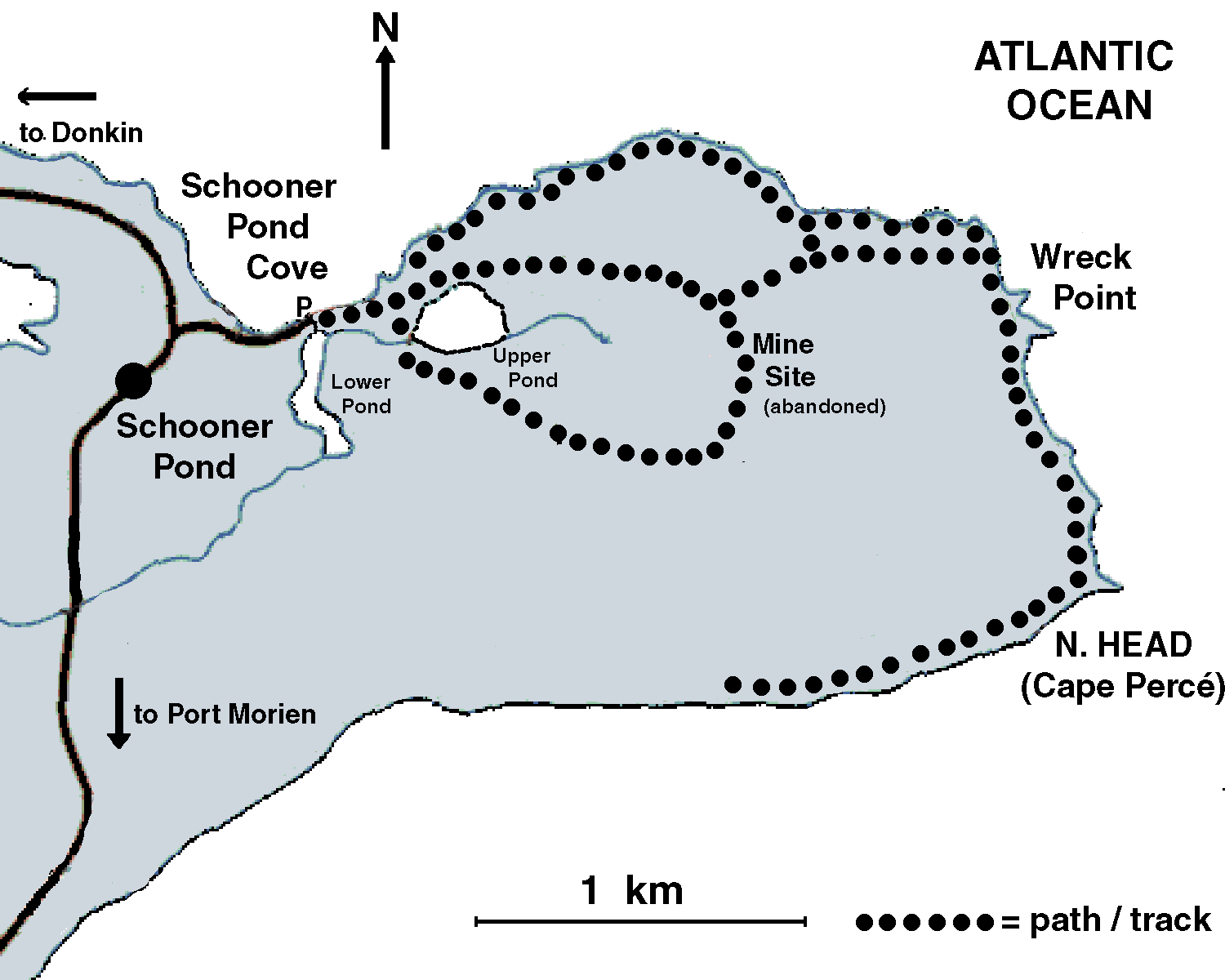 map © 2006 by Blake Maybank Cape Percé (Northern Head), a 30 metre-high headland, supports a small colony of Black-legged Kittiwakes and a few Great Cormorants, and Black Guillemots nest in the rocks all along the base of the headland.. Flint Island Lighthouse is visible 3 km to the E. There is a larger colony of Great Cormorants south of Cape Percé, with several hundred pairs present. This latter colony marks the end of the coastal trail; at this point you must retrace your route along the coast to the mine site and Schooner Pond. There are trails S of the mine site and Upper Schooner Pond, but these are wet and less productive of migrants, and may be skipped. |
| The
nearest airport is in Sydney, 15 minutes from the Sanctuary. The nearest international airport is in Halifax, a five hour drive. By road (the Trans-Canada highway), the sanctuary is a 5.5 hour drive from the New Brunswick border. Order a Free Nova Scotia Highway Map either Online or by Phone: 1-800-565-0000 (Canada & United States) |
| Mapquest Maps for Big Glace Bay Lake Migratory Bird Sanctuary:
western overlook, eastern access, Aerial View |
| On-line Road Map of Nova Scotia |
| Map of Cape Breton Regional Municipality |
| Weather & Tides |
| WEATHER
|
| Sydney inland weather forecast: Metric or Imperial |
| Cabot Strait marine weather forecast |
| Forchu marine weather forecast |
| TIDE TIMES - NORTH TO SOUTH |
| North Sydney tide time & locator map |
| Sydney tide time & locator map |
| Glace Bay tide time & locator map |
| Louisbourg Harbour tide time & locator map |
| Tourism
Information & Accommodations Note: local accommodatons may be booked free-of-charge through the provincial Check-In service: 1-800-565-0000 |
| Cape Breton Island Tourism |
| City of Sydney & Street Map |
| Lodgings
in and near Glace Bay: Glace Bay B & B, 2 Haley Dr., Glace Bay, (902) 849-8036 Vespers by the Sea B & B, 17 Eleventh Street, Glace Bay, (902) 842-5224 Becky's B&B, 208 Main Street, Reserve Mines, 902-849-2974 Port Morien Rectory B&B, Port Morien, 902-737-1453 Lingan Bay View B&B, 2710 Lingan Road, Lingan Bay, 902-862-6127 Jacques Cartier Motel, Rte 4 (2 km west of Sydney Airport); 902-539-4375 |
| List of Lodgings in Sydney, Cape Breton |
| Cape Breton Regional Municipality Information |
| Marine Atlantic Ferry Information (North Sydney - Newfoundland) |
| Birds of Cape Breton Regional Municipality |
| Cape Breton Naturalists Society |
| Some other
Nearby Birding Sites
&
Routes (Site numbers from Birding Sites of Nova Scotia) |
| A6 South Bar, Sydney Harbour & Aerial view of South Bar |
| A7 Cow Bay Road Trail & Trail Map & Description |
| A8 Sydney Airport (entrance off Hwy 4) |
| A9 Dominion Beach Provincial Park (entrance) & Aerial view of Lingan Bay |
| B2
Schooner Pond & Cape
Percé (Northern Head), including: parking area, and Aerial View |
| B3
Morien Bay (Aerial
view), including: Morien Bar (Port Morien Beach) (west access) & Aerial view |
| B4
Mira Bay (Aerial
view), including: Long Pond and MacVicar’s Pond Mira Gut Catalone Beach |
| B7
Louisbourg, including: Lighthouse Point Louisbourg Harbour -- wharf (and Aerial View) Fortress of Louisbourg Kennington Cove Provisional Louisbourg Area Species' List (PDF file) |
| Cultural Heritage Attractions |
| City of Sydney |
| Cossit House Provincial Museum |
| Jost House |
| St. Patrick's Church Museum |
| University College of Cape Breton Art Gallery |
| Whitney Pier Historical Society Museum |
| Town of Glace Bay |
| Marconi National Historic Site |
| Cape Breton Miners' Museum |
| Glace Bay Heritage Museum |
| Town
of Louisbourg |
| Fortress of Louisbourg National Historic Site |
| Sydney & Louisburg Railway Museum |
| Fortress Louisbourg Association |
|
Elsewhere in CBRM |
| Celtic Colours International Music Festival (October, island-wide) |
| Dominion Heritage Schoolhouse Museum (village of Dominion) |
| Fort Petrie Military Museum (village of New Victoria) |
| Main-à-Dieu Fishermen's Museum (village of Main-à-Dieu) |
| North Sydney Heritage Museum (town of North Sydney) |
| Tompkins Museum (village of Reserve Mines) |
Western Reef-Heron Photos
(more are welcome -- send me links to your photo page,
or I can post copies on this page)
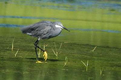
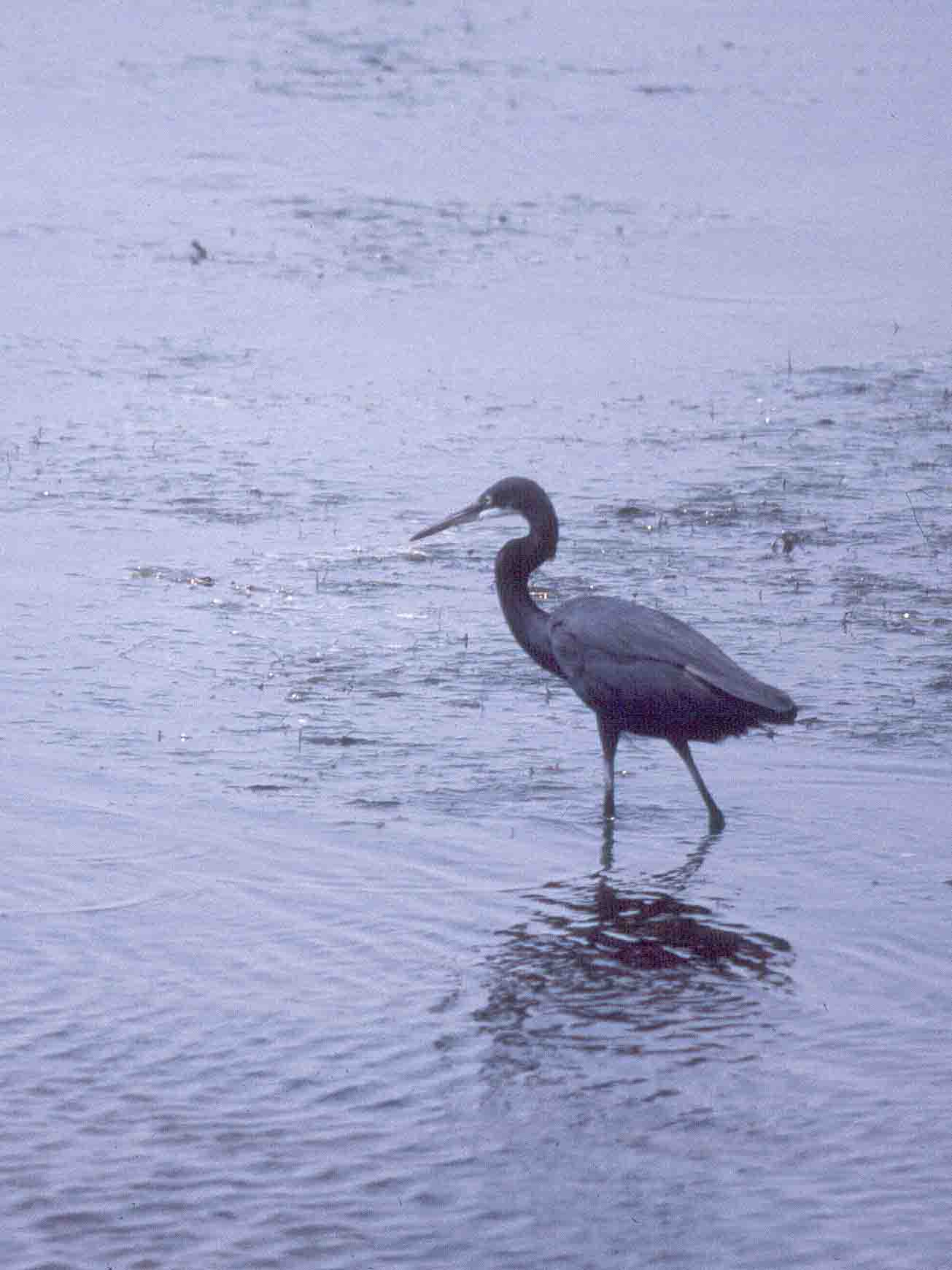
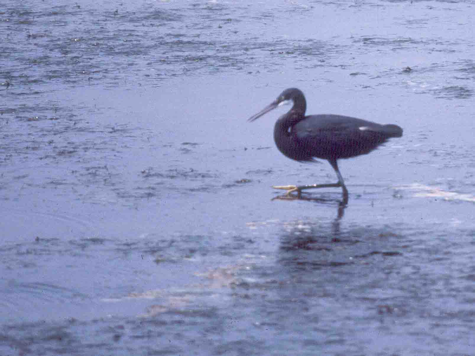
Western Reef-Heron (Egretta gularis) at Glace Bay Sanctuary
photo © 2006 by Richard Stern
Richard Stern has a nice array of photos HERE, and a short video HERE.
Cathy Murrant has posted some fine photos under the rare birds section of her web site:
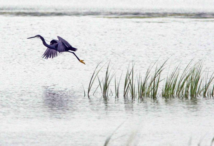
Western Reef-Heron (Egretta gularis)
photo © 2006 by Hans Toom
Hans Toom has more fine photos HERE.
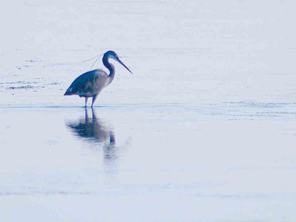
Western Reef-Heron (Egretta gularis) on August 1
photo © 2006 by Dave Tanahill
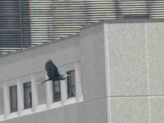
Western Reef-Heron (Egretta gularis) passing by the Glace Bay Hospital
photo © 2006 by Blake Maybank
Nostalgia Nantucket Photos
